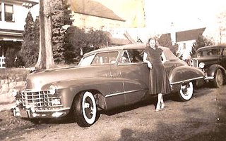
 When drivers behave rudely towards us, we tend to perceive them as being "hostile to cyclists". But what I wonder sometimes, is whether this is a fair assessment given how drivers behave to one another.

 That's how it seems to go when you are a parent. Your whole world can be turned into pros and cons columns. It's never super clear what we should do. There is rarely a right or wrong choice, just better and worse choices. And you rarely know which one it is, until after the fact. It's a maddening thing to a control freak like me.


Land Office, Fort Wayne, Ia. Sept 20 1837
I, James Joslin, [of] Delaware County, Ohio do hereby apply for purchase E ½ NW ¼ Section numbered 25 in Township numbered 32 N. of Range number 8 E. containing 80 [acres], according to the returns of the Surveyor General, for which I have agreed with the Register to [pay] at the rate of One Dollar and Twenty-five cents per acre.
for James Joslin
Price Goodrich
I, Robert Brackenridge, Register of the Land Office, do hereby certify that the lot above de-[scrib]ed, contains 80 acres, as mentioned, and that [the p]rice agreed upon is one dollar and twenty-five cents per acre.
R. Brackenridge, Register.
 The interesting thing about the land entry application is that the entry was signed by Price Goodrich "for James Joslin" indicating, perhaps, that James didn't make the trip to the land office. I wonder if he even saw the land before he purchased it or did he rely on Price to select good land? Also, did you notice the abbreviation "Ia." was used for Indiana?
This record also confirms the speculation noted by Irwin Joslin in his letter to my Grandmother on July 29, 1969 that James was "of Delaware County, Ohio" indicating that he was indeed living there, at least in 1837.
The receipt for payment is also dated September 20th 1837 and it shows that James paid $100 for his 80 acres.
 The land purchase was not filed in Whitley County until October 14, 1885. It was found, after an extensive search, in Whitley County Deed Book 15, page 314. Two paragraph breaks have been added to the transcription to make it a bit easier to read.
[page] 314 certificate No. 20721 } United States to James Joslin.
Filed Oct. 14" 1885 at 3 P.M.
The United States of America, To all whom these Presents shall come, Greeting: Whereas James Joslin of Delaware County, Ohio has deposited in the General Land Office of the United States a Certificate of the Register of the Land Office at Fort Wayne where by it appears that full payment has been made by the said James Joslin according to the Provisions of the Act of Congress of the 24th day of April, 1820, entitled "An Act making further provision for the sale of Public Land" for the East half of the North West Quarter of Section twenty five in Township thirty two North of Range Eight (8) East in the district of land subject to sale at Fort Wane Indiana, containing eighty acres, according to the official plat of the survey of the said Lands, returned to the General Land Office by the Surveyor General, which said tract has been purchased by the said James Joslin.
Now know Ye, That the United States of America, in consideration of the Promises, and in conformity with the Several acts of Congress in such case made and provided, Have Given and Granted and by these presents Do give and Grant unto the said James Joslin, and to his heirs, the said tract above described. To Have and To Hold the same together with all the rights, priviliges, immunities, and appurtenances of what so ever nature, thereunto belonging unto the said James Joslin and to his heirs and assigns forever.
In Testimony Whereof, I Martin Van Buren, President of the United States of America, have caused these letter to be made Patent, and the Seal of the General Land Office to be hereunto affixed. Given under my hand, at the City of Washington, the twentieth day of August in the year of Our Lord one thousand eight hundred and thirty eight and of the Independence of the United States the sixty third.
By the President: Martin Van Buren
By M. Van Buren Secy.
Jos. S. Wilson acting Recorder of the General Land Office
Ad interimRecorded. Vol 42 Page 127

 Of course, just because James Joslin purchased land in Whitley County does not necessarily mean that he ever actually lived in the county. There were land speculators back in those days too... but he wasn't one of those speculators.


 If you do the tour part, you get a piece of candy at the end. Last time we were with Diana and she twisted our arm to go on it twice, just to get two pieces of candy. As much as Auburn and I hate candy, we went along with it. This time was even better. When we came off the tour ride, there was a lady doing surveys there. Aric, Nathan and I all qualified to do one. Which means we got to eat chocolate while doing the survey and then they gave us a free full sized candy bar for participating. Austin got the candy bar because he had to sit and wait for us. We went to explore all the other goodies afterward and bought a bag of Hershey Kisses each.


 After all of that fun, we headed to Lancaster to try the Shady Maple Buffet. We somehow missed this when we were in the area two years ago. We quite literally stuffed ourselves in ways I am not personally proud of. It was soooooo good and there was so much food to pick from. Half of my plates were for the desert part alone.
 The western side of Mount Saint Helens as seen from the Visitor Center at Silver Lake, 46 road-miles away.
 From a viewpoint on the north-northwest side.
 Clouds covered the upper half of the volcano for the entire afternoon with an occasional break, which briefly revealed the peaks. This, and the remaining photos were taken from the Johnston Ridge Observatory. Named for David A. Johnston, a volcanologist on duty nearby on that fateful day. His last words were “Vancouver, this is it!”
 The lateral blast exploded to the north toward what is now Johnston Ridge and, quite literally, destroyed everything in its path.
 The mountains and valleys were tall old-growth forest. Now all that remains are a few denuded logs lying about like pick-up-sticks.
 A park service sign nearby tells a tale of the blast as “spoken” by this stump: “Step up and look at me carefully. Notice my shattered trunk, my missing top. I once stood 150 feet tall, surrounded by a beautiful forest of green and growing trees. When the blast exploded sideways out of the mountain, it plowed through the debris avalanche and swept across the landscape, picking up and carrying large chunks of rock, ice, and splintered wood.”
 Down in the valley, the blast dumped 680 feet of debris, filling Spirit Lake to the east with logs and ash.
 Johnston Ridge was completely denuded. Spirit Lake lies beneath the far ridge at left-center and St. Helens rises up from the valley on the right.
 The early evening light emphasizes the ridges and the gulleys now being carved out by the flow of water.
 Another view of cloud shrouded St. Helens from Johnston Ridge in the early evening. All photos were taken on Sunday, September 12th.
 For starters, we had grilled octopus on a toast and I had smoked salmon with almond on a toast as well. Blondine's other starter was a sardine (not in foto).
 Paired with fresh special sorlut oysters and a glass of chilled chardonnay. Blondine had another toast with ham on top as well (not in foto).
 Yours truly, the glutton.
 We walked to the seafood stand and ordered a plate of grilled octopus sprinkled with paprika and sizzled with extra virgin olive oil. Blondine and I shared this.
 After our chardonnays were done, we decided to go red. This time a Rioja.
 We ordered the Rolls-Royce of all Spanish ham, the bellota. Here is the server busy carving our bellota ham.
 Bellota means acorns because these select swines are only fed with it. This is just heaven. 100 grams costs almost 20 Euros. We shared this as well.
 For my dessert, since I am not a sweet tooth type, I settled for an olive wrapped with an anchovy and topped with green pepper.